Is there a region that is so beautiful it impresses you time after time? Southern Oregon Coast is exactly that place for me! Rugged cliffs covered with evergreens, hills covered with wildflowers, sunsets so stunning you cannot breathe, or foggy days that cover you like a soft blanket, waterfalls, and mountains, how can all of these be in one place? If it were closer to Bay Area, we would spend all weekends there, but alas!
But if you have some time on your plate and willing to drive some amazing roads, proceed reading. Wow, right?
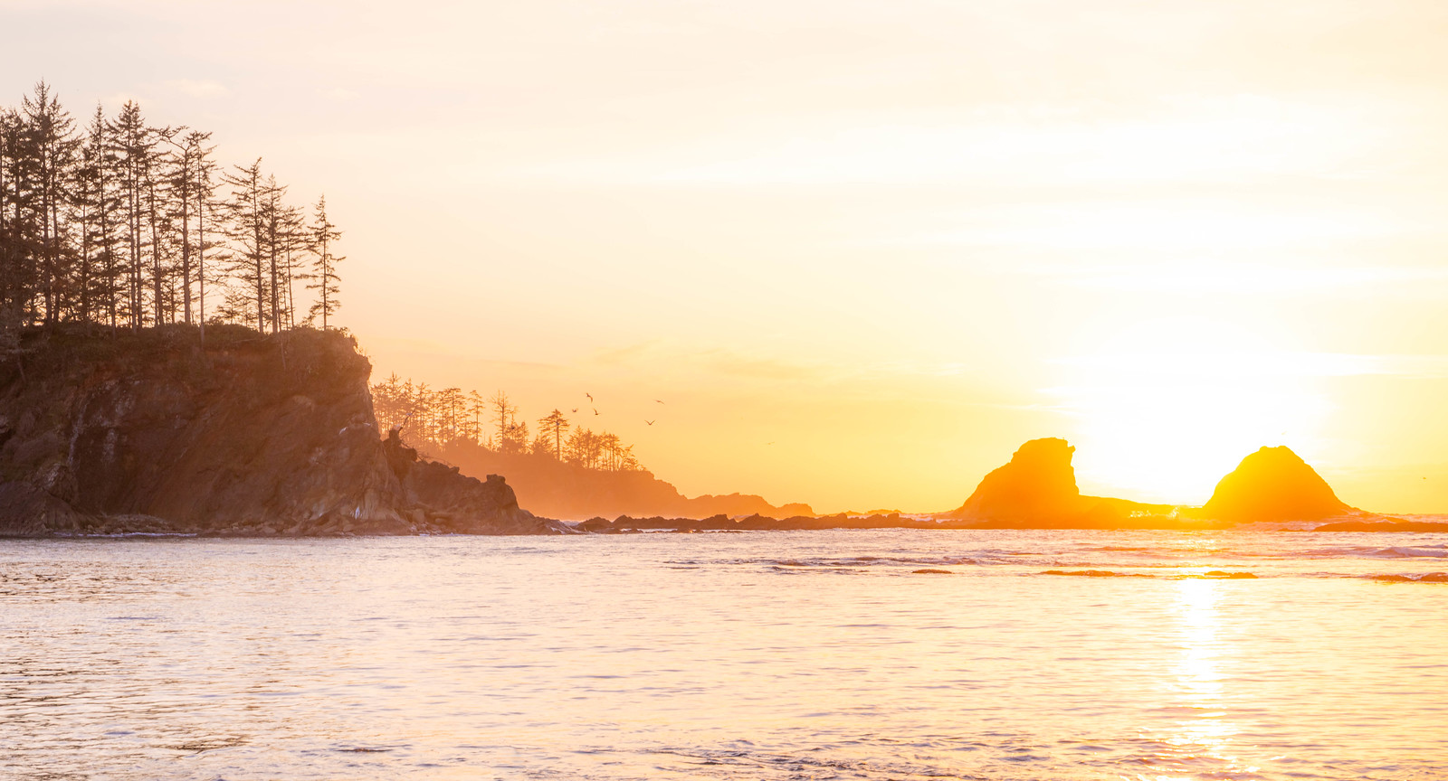
Samuel H Boardman Scenic Corridor
This place is now all over Instagram nowadays. Some views are hard to reach and somewhat dangerous. Based on your skills and desire to get some adrenaline, there are several stops to make and some hike to take (from south to north):
- Cape Ferrelo Loop – short trail on a grassy hill. The hill is covered with wildflowers in Spring.
- Indian Sands – a longer trail that has all the best things the park has to offer. Still on my TODO list.
- China Beach – one of the least known places in the park, but so scenic. Check the tide chart before the visit.
- Natural Bridges is one of the busiest parking lots in this post, not only in the park. People come here to hike for the famous arch view. WARNING: the trail is not official; it could be dangerous if you come unprepared (I mean slippery or crumble). Please don’t do it with animals or kids. And think twice before doing it.
- Secret Beach – a popular but amazing place accessible with a short downhill hike. Read: you will need to hike uphill back to your car.
- Arch Rock Viewpoint – the nice viewpoint that doesn’t need any hike to get the view.


Row 1 – Secret Beach; Row 2 – Arch Rock Viewpoint; Row 3 – Natural Bridges.
Pistol River State Scenic Viewpoint
Most travelers will drive past this scenic corridor. However, if you stop at the parking lot and hike over the high dunes, you will get along the beach with scenic views over the rocks in the ocean. There are a bunch of trails along dunes to explore for a whole day. Or, cross the dunes, and walk the beach south towards the haystacks of Crook Point. Don’t miss the northern shore of Pistole River and its stacks.


Cape Sebastian
A relatively unknown place on the coast has one of the shoreline’s best views plus a good trail to get those daily steps. 2.7 moderate trail will lead you through the wooded area down to the beach. In May, expect to find wild irises along the portion of the trail.


Sisters Rock State Park
Small State Park along the coast consists of three prominent rocks. The short trail leads to a grey sanded beach. Expect wildflowers in late spring-early summer and a stunning sunset on clear days.


Cape Blanco
Cape Blanco State Park is centered around a small picturesque lighthouse. And it’s one of the windiest places we’ve ever been but one of the prettiest: it has one of the best shore views, famous haystack, lighthouse, and wildflowers of all sorts in the season. Hughes Historic House is also a part of the park. See my old post about our trip there.
You can camp in the park; they have a nice campground and even cabins if you prefer a more comfortable way.


Kronenberg County Park
One of the nicest county parks we’ve ever seen, Kronenberg is an amazing place to explore for hours (especially during low tide when you can walk closer to the sea stacks). Wooden stairs down the beach have an amazing overview of the area and rocks. Do not miss the arch in one of the biggest rocks.


Cape Arago
This place has everything: cliffs with stunning views, shady trails, distant lighthouse. And it’s one of the places where photographers flock in winter to capture waves crashing over cliffs and rocks.
There are several secluded coves to explore and check marine life, or you can drive to one of the viewpoints for sunset. Don’t miss the view of Cape Arago Lighthouse on one of the islands closer to the shore from Cape Arago Lighthouse Viewpoint (obvious, right?).


Sunset Beach
The place with sunset in the name must have amazing sunsets, right? Sunset Beach is a cove with a fine sandy beach. Tidepools here are very interesting, so plan your visit around low tide. And, the parking lot overlooks the cove and beach, so one could eat his dinner and watch how the sun slowly slides behind the horizon.


Waterfalls of Coquille River corridor
The lesser-known region of Southern Oregon Coast (not exactly the coast but coastal range) could be itself the amazing day trip. Start from Bandon and drive towards the small town of Powers, where you could stop for a short break from the driving and admire Mill Creek Falls right from the bridge above the river.
From Powers drive NF-33 south towards Big Tree Trailhead. The short and easy trail will lead you to the spectacular Elk Creek Falls.
However, the further south, you will find the two most impressive local falls: Upper Coquille River Falls and Coquille River Falls. I suggest driving first towards Upper Coquille River Falls. The small pullout right across seasonal waterfall is the start of a very steep but short trail. Fortunately, there are ropes to help you get closer to the creek.
Coquille River Falls are better accessible. Trailhead is around 1.5 miles from the start of NF-3348; it’s closer on the easy side but becomes steeper closer to the falls. The waterfall is about half a mile from a trailhead.


1 – Upper Coquille River Falls; 2 – the trail towards Coquille River Falls; 3 – Coquille River Falls; 4 – Elk Creek Falls

Panorama of Upper Coquille River Falls
Info and links
- Official Samuel H Boardman site to check on closures, maps, and up-to-date info.
- Cape Sebastian Trail description on AllTrails
- Official Cape Blanco State Park page. Here you can reserve your campsite at Cape Blanco.
- Official Cape Arago State Park page where you can find info about fees and closures.
- Cape Arago trails on AllTrails
- For more information on Sunset Beach, see Sunset Bay State Park page. They also have a real-time web camera so you can check weather conditions before arrival.
- AllTrail description of Elk Creek Falls is here. For Coquille River Falls, see this page.