

That hike was added to my winter hikes to-do list. But I did not consider it because of a few reasons until the previous Thursday. Forecast changed so quickly, and rainy Sunday become day without rain. So we decided to use that time for a good.
There is no Peter Creek Falls marked on the map of Long Ridge Open Space Preserve, and you’ll not find the trail with this name there. But if you’ll open google maps, search the park, and swipe to the Peter Creek. And then you’ll see the unmarked trail. Yeah, that will be trail you need.
I read about this falls two or three times in different sources. All they told to take the path that follows the barbed-wire fence than to find some small hidden and, of course unmarked, trail before crossing Portola Heights Road.

As you could see, there is no need to search for hidden trails. From the parking lot across the Upper Stevens Creek County Park, take Peters Creek Trail and then turn right to the Ridge trail. Follow it to the very crossing with a road. Pass through the gate; you will see the separation of the path. You’ll need the left one. Then follow it.
At first, the trail will find Peters Creek.


And then the trail will path through boulders (prepare for some easy climbing).
The waterfall is nice, but not easily accessible. There is no good viewpoints or place where you could see falls in once.


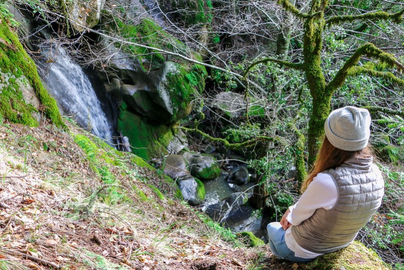
Also, I think a waterfall is even bigger and pretty high, but we found no way down.


Though the trail is unmarked, it’s better to hike there earlier. We returned to the car before the noon, and we saw crowds followed the path near fence!
Update from the hike on Feb 10th, 2019
So we retrace our way back to the waterfall. The trail was soaking wet and slippery. However, we managed to hike a bit further this time. Still didn’t get to the base of the falls.
Here are photos from the top section to the middle.


Trail information
- The trail is a bit more than 3 miles from the trailhead to the middle section of the falls
- Long Ridge Open Space Trailhead on Google Maps, it’s about 25 miles from San Jose or 57 miles from San Francisco
- Official Long Ridge Open Space Preserve page
- All posts about Long Ridge Open Space on miladidit.com
-
Trail recording
Your directions were perfect but you should go now. It’s gorgeous & there’s actually a better fall below three first one. It just takes some scrambling to get to. I got some great pictures & a video.
Hi Heather, thanks! We actually tried a few times to scramble down to the base of the falls though I was afraid to take risks 🙂